Students aid state agency in erosion assessment
Published 9:10 am Thursday, September 28, 2017
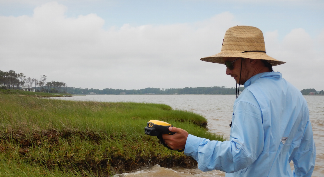
- Craig Rose of the Longwood Institute of Archaeology maps a Mathews County shoreline with a high-accuracy GPS.
Two prehistoric camps — one dating from as early as 16,000 B.C. — are among more than 150 archaeological sites on the Chesapeake Bay that could soon disappear due to coastal erosion and sea-level rise, according to a study conducted by the Longwood Institute of Archaeology.
According to a Longwood University press release, the Virginia Department of Historic Resources (DHR) hired Longwood’s institute to calculate the extent of shoreline change and assess the effects of that change on 313 archaeological sites in four counties on the Northern Neck and Middle Peninsula.
The release cited that results show that 153 of the sites are threatened, including the Mathews County site that contains artifacts dating back to the Paleo-Indian period, approximately 16,000-8,000 B.C. Longwood archaeologists predict the site will be destroyed in 10 years based on the current erosion rate of 4.8 feet per year.
“This is groundbreaking research that is a critical piece in managing cultural resources at the water’s edge,” said Dr. Brian Bates, the institute’s executive director and professor of anthropology at Longwood. “No other project that I know of combines a detailed survey of shoreline erosion with the predictive model that we developed.”
“What we are producing will be a very valuable tool for DHR, which needed to know which archaeological sites were most threatened,” Bates said.
According to the release, the extent of shoreline change from 1937 to 2013 at 313 historic and prehistoric archaeological sites in Northumberland, Lancaster, Mathews and Middlesex counties was documented by Bates; Mary, the institute’s laboratory supervisor; Craig Rose, the institute’s principal investigator, among other staff aided by students. They measured shoreline change not only on the Chesapeake Bay, as called for in the contract with DHR, but also on inland waterways in the four counties.
“Of the 153 threatened sites,” Farrell added, “28 are eroding so quickly that we predict they will be gone within 50 years.”
Detailed data compiled by institute archaeologists will become part of the database for DHR, which is the repository of archaeological sites for the commonwealth.
The release cited through a sophisticated software package called AMBUR, the archaeologists measured shoreline change for every 5 meters along more than 1,200 miles of shoreline. Each 5-meter interval was recorded as a “data point” by AMBUR, one of more than 386,000 data points. “Aerial photographs from 1937, 1994 and 2013, and another software tool called ArcGIS, also were key components of the project,” officials said in the release. The institute submitted a report to DHR this summer that contains information on each of the sites, including its ‘level of shoreline movement’ from among 11 levels, how many years until water reaches the site and the site’s projected lifespan.”
The Longwood archaeologists found five previously undocumented archaeological sites, which they surveyed in addition to 308 sites previously identified by DHR. They visited 76 sites, for which permission had to be granted by the landowner.
Longwood archaeologists also developed a “predictive model” for determining locations that might contain previously undocumented archaeological sites.
According to the release, the predictive model that was developed is based on similarities in environmental conditions — including soil type, soil texture and elevation — between known and potential sites. The so-called Longwood VPC (Vulnerability Potential and Condition) Model will be used in a similar upcoming project funded by DHR in Accomack and Northampton counties on the Eastern Shore.
“I’ve worked in contract archeology for 15 years, and this is the most interesting project I’ve ever done. It really is unique,” said Rose in the release, who coordinated the predictive modeling.
Longwood students and Dr. Walter Witschey, a former Longwood professor who is a research fellow with the institute, helped with the work, which began in Oct. 2015. Students also will be involved in the upcoming project on the Eastern Shore.
“The institute has applied for grants that would fund two similar shoreline surveys on the Chesapeake Bay: one on the Atlantic Ocean coast of Accomack and Northampton counties, the other covering the entire shoreline of the bay and its tributaries in Virginia and Maryland,” officials said in the release.
“The Longwood shoreline survey, funded by the National Park Service, was among several DHR-administered projects that were prompted by the damage caused by Hurricane Sandy in 2012,” officials said in the release. “DHR is devoted to preserving cultural resources.”