Latest look at Hurricane Florence
Published 11:29 pm Thursday, September 13, 2018
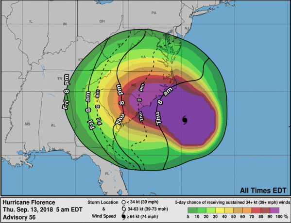
- NATIONAL WEATHER SERVICE Pictured is the earliest reasonable arrival time of tropical storm-force winds. Tropical storm conditions are possible beginning later Thursday into Friday night/Saturday morning.
According to the National Weather Service (NWS), Hurricane Florence, now a category two hurricane, is expected to slow down at the North Carolina/South Carolina coast and make landfall early Friday morning.
Tropical storm conditions are expected to begin later today and linger into Friday night and Saturday morning.
The Farmville area has an elevated wind threat and maximum wind gusts of 31 miles per hour.
Though approximately 1.5 inches of rainfall on average is forecasted in the Farmville area for total precipitation from the storm, locally higher amounts of rainfall or flooding may be possible, the NWS cited.
“Though Hurricane Florence remain to our south we will still experience Tropical Storm force winds, tidal flooding and periods of heavy rain,” officials from the National Weather Service said.
A weather advisory for the region cited that “significant impacts from Hurricane Florence will be possible through Saturday night. There is potential for strong winds, heavy rainfall, and localized flooding.”